


💛 A quick favor, if you've got a second.
We're really happy that you chose to read one of our stories and sincerely hope you'll stick around to read more. We took our paywall down — for now — but that won't last forever, and when the gate goes back up, we'd love for you to already be on the inside.
It's free. So please enter your email here and don't forget to like and follow us on all of your favorite Social Media platforms!
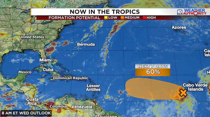
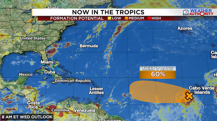
Invest 96L, a robust tropical wave traversing the eastern Atlantic toward the west, has shown minimal organizational changes since Tuesday as forecasters increasingly doubt it will strengthen meaningfully in the coming days. The sophisticated computer models that initially projected rapid intensification—particularly the European model and the American GFS system, which had previously forecast 96L reaching hurricane strength—have substantially revised their outlooks in recent updates, now depicting the system facing considerable obstacles as it crosses the deep tropical waters between Africa and the Caribbean.
The National Hurricane Center responded to this shift by downgrading its official development probability for 96L from high to medium status early Wednesday. Nevertheless, the system remains a potent atmospheric feature, and modest additional organization could still allow it to achieve tropical depression or named storm status within the next one to two days before atmospheric conditions deteriorate as the weekend approaches. If development occurs, the next available name would be Dolly.
Google’s DeepMind artificial intelligence forecast system, which established itself as the premier hurricane prediction tool during an exceptional 2025 season, has demonstrated a consistent pattern of early detection combined with rapid confidence reduction when conditions become unfavorable. The machine-learning ensemble model initially assessed a 60 percent development probability for 96L several days ago, then reduced that to 40 percent yesterday and approximately 20 percent today, reflecting dramatically diminished near-term formation chances.
DeepMind does project a delayed development scenario in approximately one week as the disturbance approaches the southwestern Atlantic near the Bahamas, a forecast trajectory the model has maintained for several days. While these probabilities remain modest and have declined since yesterday’s assessment, this potential represents a monitoring point given the system’s eventual proximity to Florida and the continental United States. The region experiences record or near-record warm ocean temperatures for this time of year and lies beyond the Atlantic shear zone typically suppressing activity, warranting continued observation of forecast trends.
The trajectory of Invest 96L this week remains uncertain, with intensity models suggesting any organized development would likely peak at tropical depression or weak-to-moderate tropical storm strength over the next several days. Whether 96L will overcome environmental barriers to reach these developmental thresholds before encountering substantial atmospheric headwinds this weekend has yet to be determined. Eastern Caribbean island interests should continue monitoring the system’s progression, though current forecasts indicate that 96L or any resulting feature poses no significant immediate threat to populated areas.
A separate Atlantic disturbance previously designated Invest 95L in the middle North Atlantic has ceased development prospects, with its remaining low-pressure circulation being rapidly transported eastward to sea by powerful jet stream winds Wednesday.

More Stories
Archaeologists Unearth 1,300-Year-Old Trading Hub Near Ancient Jaffa in Israel
Month-Long HEPA Use Linked to Faster Cognitive Processing in Middle-Aged Adults
NASA Launches $4.3 Billion Roman Space Telescope to Search for Exoplanets and Dark Energy