


💛 A quick favor, if you've got a second.
We're really happy that you chose to read one of our stories and sincerely hope you'll stick around to read more. We took our paywall down — for now — but that won't last forever, and when the gate goes back up, we'd love for you to already be on the inside.
It's free. So please enter your email here and don't forget to like and follow us on all of your favorite Social Media platforms!
A system expected to strengthen into Tropical Storm Lala is positioned roughly 800 miles southeast of Hawaii and threatens to bring hazardous conditions to the islands this weekend. The disturbance, currently designated Potential Tropical Cyclone One-C, is forecast to organize into a named tropical storm by Thursday and gradually intensify as it approaches the Big Island early Saturday local time.
Recent forecast models have shifted the projected track slightly southward and away from Hawaii, offering modest relief to residents and visitors. Nevertheless, meteorologists warn that significant impacts remain likely across multiple islands, including the Big Island, Maui, Lanai, Molokai, Oahu, and Kauai, with threats encompassing heavy rainfall on exposed slopes, flash flooding, strong winds, and dangerous surf conditions along east-facing shores.
The last tropical storm watch or warning issued for Hawaii occurred nearly two years ago, while Hurricane Douglas in 2020 marked the most recent hurricane watch for the state. Historical records dating to 1949 show only 11 tropical storms or hurricanes have passed within 50 miles of the islands, with Tropical Storm Olivia in 2018 being the most recent named storm to directly impact the archipelago.
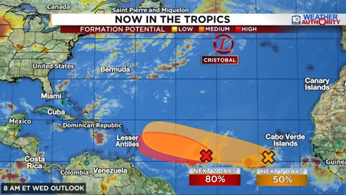
Meanwhile, two tropical disturbances designated Invest 92L and Invest 94L continue organizing over the central and eastern Atlantic between Africa and the Caribbean. Invest 92L, the westernmost system, could develop into a tropical depression or named storm as soon as Thursday under the name Dolly, though strong wind shear is expected to rapidly dissipate the system by weekend as it enters the eastern Caribbean.
Invest 94L, positioned further east, may sustain longer organization into early next week and could maintain tropical depression or storm status as it moves near the easternmost Caribbean islands. Meteorological models indicate both systems face significant obstacles including wind shear and dry air that will limit their intensity development.
Tropical Storm Cristobal, meanwhile, continues to weaken over the far North Atlantic on Thursday and poses no threat to populated areas.


More Stories
New York’s Colombian Community Mobilizes Relief Efforts Following Recent Earthquakes
Nepal Buries Hundreds of Flood Victims in Mass Graves as Identification Efforts Lag
Hurricane Karina Intensifies Over Pacific, Potential Major Storm Looms This Week