


💛 A quick favor, if you've got a second.
We're really happy that you chose to read one of our stories and sincerely hope you'll stick around to read more. We took our paywall down — for now — but that won't last forever, and when the gate goes back up, we'd love for you to already be on the inside.
It's free. So please enter your email here and don't forget to like and follow us on all of your favorite Social Media platforms!
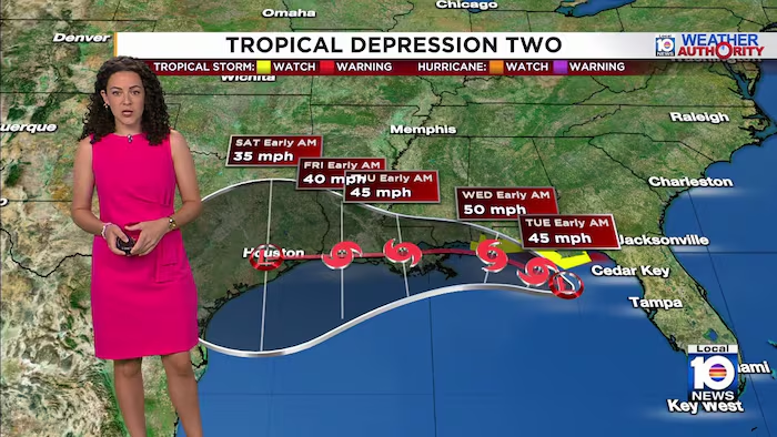
Meteorologists expect Tropical Depression 2 to develop into a tropical storm by Monday as it tracks toward the Florida Panhandle and Gulf Coast region. The system, located approximately 120 miles south of Panama City as of Monday morning, was moving northwest at 3 mph with maximum sustained winds of 35 mph.
A Tropical Storm Watch remains in effect along Alabama’s Gulf shoreline from the Florida border westward to the Mississippi border. South Florida is not expected to experience direct effects from the system this week, with conditions remaining largely clear for the region.
Drier air is anticipated to move into South Florida by midweek following the system’s passage. With reduced storm potential, temperatures will climb above seasonal averages, and heat index values are projected to approach Heat Advisory thresholds on successive afternoons.

More Stories
New York’s Colombian Community Mobilizes Relief Efforts Following Recent Earthquakes
Nepal Buries Hundreds of Flood Victims in Mass Graves as Identification Efforts Lag
Hurricane Karina Intensifies Over Pacific, Potential Major Storm Looms This Week